A Common Evidentiary Infrastructure: On participatory methods of optical survey, recording the destruction of Yazidi cultural heritage in Sinjar
The Sinjar region of northern Iraq is one of two areas that comprise the heartland of the Yazidis, a religious and cultural minority that has long faced persecution in both Iraq and Syria.
In August 2014, the terrorist group known as ISIL invaded the region. Unprotected by the armies of Iraq or the nearby Kurdish autonomous region, Yazidi villages and towns across the region were captured and razed, and their inhabitants massacred. Thousands of Yazidi women and girls were trafficked into slavery. Religious buildings and sites of Yazidi cultural heritage were specifically sought out and destroyed. ISIL was driven out of the region in late 2015. But today, many of the Yazidis that escaped still remain in refugee camps in Iraq or Syria, traumatised and reluctant to return.
Forensic Architecture (FA), in collaboration with Yazda, the international representative body for the Yazidi community, set out to train researchers in DIY surveying, mapping and documentation techniques, to support the investigation of the genocide perpetrated by ISIL.
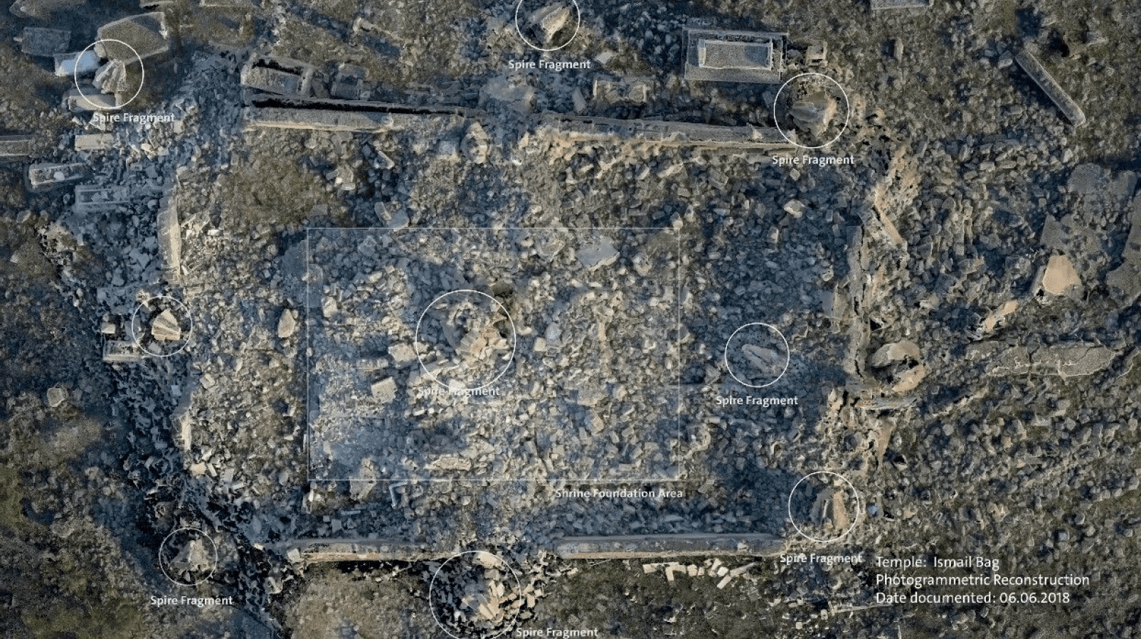
This chapter examines the destruction of Yazidi cultural heritage in the Sinjar region of northern Iraq following the 2014 attacks by ISIL, during which Yazidi towns were razed, communities massacred, and religious sites deliberately targeted. In response to the absence of official investigative mechanisms and the scarcity of reliable media traces, Forensic Architecture, in collaboration with Yazda, developed participatory modes of optical survey, mapping, and documentation to support evidence gathering for human rights and heritage preservation purposes. The chapter uses this project as a case study to articulate how grassroots, community led practices produce operational visual records of cultural heritage both during and after conflict.
Originality lies in identifying and theorising a socio-techno-political community of practice that emerges not from institutional heritage infrastructures, but from conditions of violence, displacement, and evidentiary vacuum. The chapter reconceptualises crisis documentation as a shared evidentiary labour distributed across Yazidi researchers, survivors, and technical collaborators, offering a framework that departs from conventional top-down heritage preservation and remote sensing led approaches.
Significance is demonstrated through the chapter’s contribution to debates on culturalheritage destruction, humanrights documentation, and participatory digital methods. By foregrounding local knowledge, DIY optical survey, and situated spatial testimony, the research challenges dominant paradigms in ICTdriven crisis mapping and shows how communities under threat construct their own evidentiary infrastructures to counter ongoing erasure. It provides valuable methodological and ethical insights for researchers, NGOs, and institutions responding to culturalheritage crimes where formal mechanisms fail.
Rigour is evidenced through a detailed, practicebased examination of the techniques deployed—optical survey, mapping, realitycapture workflows, and remotesensing limitations—and through the chapter’s grounding in lived collaboration with Yazidi practitioners. The analysis systematically links technical method, political context, and epistemic constraint, offering a robust account of how participatory documentation can function as both evidence and heritage preservation.